By Sharon N. Simon
[email protected]
The Antigua and Barbuda Defence Force (ABDF) Coast Guard has issued an urgent safety appeal to local fishermen, warning that secrecy over prized fishing spots is severely hampering life-saving search and rescue operations.
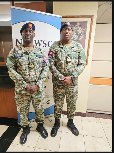
Speaking on Observer AM, Captain Vaughn Simon, Acting Commanding Officer, and Lieutenant Julio Charles urged all mariners to carry GPS tracking technology and routinely file trip plans before setting sail.
According to the officers, the single biggest obstacle in any maritime search is the ocean’s vastness. Rescuers frequently face delays because missing fishermen do not disclose their intended locations, even to family members, in an effort to keep their preferred fishing spots hidden.
“Without a GPS position or a last known location, rescuers have no landmarks to guide a search pattern,” Capt Simon explained.
Searches begin immediately once a distress call is verified with the deployment of ABDF surface vessels and the ABDF Air Wing, established in 2022. The Coast Guard also coordinates with the Maritime Rescue Coordination Centre in Guadeloupe, Antigua and Barbuda Search and Rescue (ABSAR), the Fisheries Division and the local boating community.
Lt Charles highlighted another concerning trend: fishermen borrowing compliant safety gear, such as life jackets and radios, solely to pass official licensing inspections, only to return the equipment before heading out to sea unequipped.
“Complacency is the chief failing,” Capt Simon noted, urging mariners to abandon the mindset that nothing will go wrong. He suggested implementing random safety spot checks every three to six months to ensure compliance.
To improve survival chances and search efficiency, the Coast Guard advises all mariners to leave a written trip plan with a relative, detailing departure and return times along with target GPS coordinates. Vessels should always carry essential gear, including life jackets for every passenger, flashlights, required marine pyrotechnics, a VHF radio, and reserve food and water.
For tracking, officers recommend equipping vessels with an Emergency Position-Indicating Radio Beacon (EPIRB) or using a VHF radio’s built-in distress feature. Budget-friendly alternatives, such as Apple AirTags or live-location sharing via smartphone apps such as WhatsApp, can also provide vital data during a search.
If a vessel begins taking on water or suffers engine failure, mariners are urged to contact the Coast Guard immediately rather than waiting for the situation to escalate.
Lt Charles clarified the distinction between distress signals, noting that a PAN-PAN broadcast is used when urgent assistance is needed but life is not in immediate danger, whereas a MAYDAY call is reserved for grave and imminent threats to life.
Distress calls should be repeated frequently on VHF Channel 16 and must include the boat’s exact position, the number of passengers on board, and a detailed description of the vessel, including its name, colour and length.

ABDF Coast Guard Urges Mariners: ‘Stop Fishing in Secret’